
Talking to trees
Researchers date caribou fence by reading the history told in its wood.
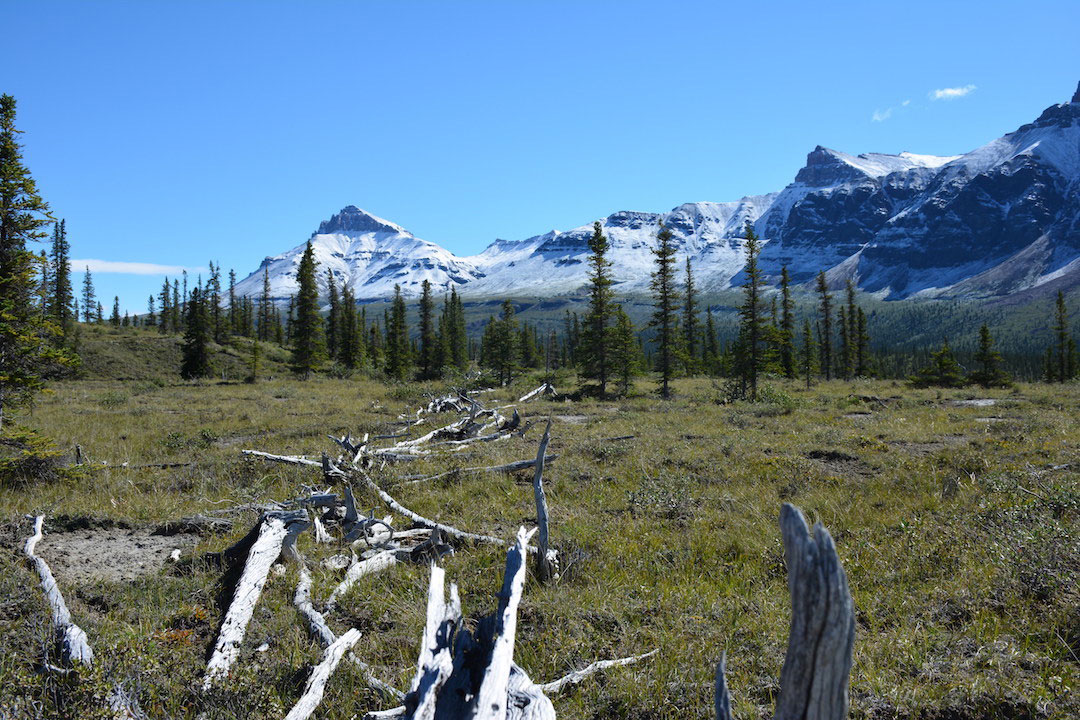
By Colleen MacPhersonTo the untrained eye, the Moose Horn Pass caribou fence doesn’t look like much, just low jumbled piles of wood stretching across the Mackenzie Mountain landscape high in the Northwest Territories.
What Dr. Colin Laroque (PhD) sees, however, is clear evidence of ancient and masterful First Nations use of the land and its resources.
Laroque, a professor in the Department of Soil Science and a faculty member in the School of Environment and Sustainability, is part of a team working to document the fence built and used by the Shútagot’ine (Mountain Dené) who occupy an area south and west of Norman Wells bordered by the Mackenzie River and Yukon. An expert in dendrochronology—the science of using annual tree growth rings to date events, environmental change and archaeological artifacts—Laroque believes the tale of the fence will be told by the wood.
“It’s like a reverse storybook. We weren’t there, but the trees were so we ask them.”
The fence is “a crude assemblage of wood—pieces of forest and downed lumber—stacked in any way, shape or form,” he explained. It is very low because caribou will not jump anything higher than about two feet, a fact “the First Nations have known forever and used to their advantage.” The wood piles run in a line about 800 metres across the slope and down into a draw, the location of a kill zone, a configuration Laroque likened to a prairie buffalo jump.
The effort to gather as much information as possible about the fence arose in response to climate change, he said. “They never used to have forest fires up there but the North is drying up and heating up like crazy,” creating a risk the fence could be lost. Shútagot’ine Elders and experts from the Prince of Wales Northern Heritage Centre in Yellowknife began the project by carbon dating two pieces of wood from the fence.
The results, however, did not match the traditional knowledge of the First Nation, said Laroque. Carbon dating put the age of the fence at the late 1800s or early 1900s, suggesting a connection with the Hudson Bay Company’s meat trade in the area, “but the First Nations people say they’ve been using it much longer than that. It was then they realized they needed a different way to date the fence because the time period is of number one importance in knowing who was there, when they were there and when they were building the fence.”
Laroque and his graduate students joined the effort in 2016 and 2017. A one-hour helicopter flight out of the small community of Tulita, formerly Fort Norman, got them to the site where they took core samples from living trees and standing deadwood as well as disk-shaped samples from fence wood.
Back in the lab, a timeline was created. Laroque said tree rings reflect everything that has gone on in the environment—wind storms, snow events, soil chemistry, fire—so by matching up known marker rings in the samples, a picture emerged that told a much longer story than the carbon dating. From about 80 samples came a timeline a millennium in length “which is almost unheard of. Of the samples we tested, we found quite a number dating from the 1400s and 1700s which says the fence was built in sections, and that fits with what the First Nations people were saying,” said Laroque.
Asked if there could be wood in the fence that dates back further than the 1400s, he had a one-word answer: "Absolutely."
The Shútagot’ine Elders were happy with the results, he said. “It’s their project and it validates that they’ve been using that environment for a long time. Caribou are still king on the food chain … and the fence shows the First Nation has been using that resource at a very sophisticated level for a long time. What they had was a good and smart system.”
While at the site, Laroque also used a specially equipped drone to capture images for a 3D model of the fence and its landscape. An additional drone sensor mapped soil compaction by caribou.
Laroque tries to return to the area annually, taking with him educational materials for the Shútagot’ine community that explain his work and findings. The Elders want these materials for their children “so they can know their culture, heritage and environment.” He has also repatriated all of the wood samples. With funding from the Canadian Mountain Network, he hopes to continue his research, seeking archaeological evidence to confirm the locations of campsites near the fence and the kill zone.
The whole project is what he described as a proof of concept that research can take many forms and involve many players.
“We’ve got cultural knowledge, wood and drone technology, and it works. Now we want to do more.”
Story from Agknowledge, Fall 2019.